|
The Five Faces of the River
From alpine lakes to the deserts parched floors, the Green and Colorado River region shows five distinct faces. Plants and animals range from the grasses, wildflowers and rodents of the Arctic Zone on the highest peaks to the sparse vegetation and drought adapted species of the Lower Sonoran desert.Temperatures within this region can vary from below freezing to over 100 degrees on the same day. Rainfall ranges from more than 40 inches to less than 5 inches annually.Few regions in the United States exhibit the contrast found here.
 |
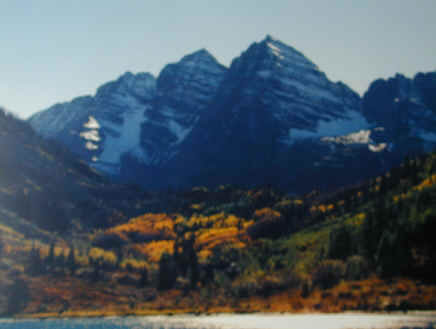
The High Country |
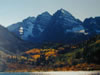
Rimming the Colorado River on the north and east High Mountain ranges , nearly 14,000 feet above sea level, are the primary sources of the waters that feed the Green and Colorado Rivers. Even in the heart of the canyon country, high mountains like the La Sal Mountains, Henry Mountains and Navajo Mountains rise like green, timbered islands in the midst of the red rocks. Some of these peaks soar to elevations over 11,000 feet and offer cool retreats even in the hottest summers.
 |
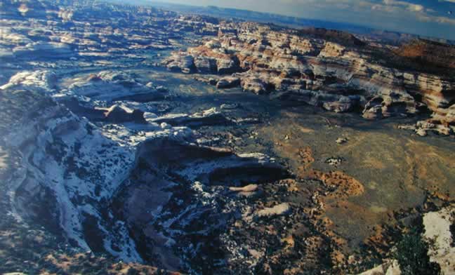
The Plateaus |
The plateaus, from a French word meaning "a flat place", are elevated and relatively flat tablelands through which the rivers and their tributaries have cut. Some of the regions plateaus are 8,000 to 11,000 feet above sea level covered with pine and fir forests. Others lower in elevation, less blessed with rainfall, form sheer walled mesas and benches.
 |
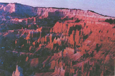
Standing Up Country |
This area, situated in the heart of the region, show cases some of the most incredible natural landscapes and geologic features found anywhere on earth.
Here the forces of erosion have carved the predominantly horizontal layers of rock, forming natural arches and bridges of all sizes, beautifully proportioned spires, and an infinite variety of buttes, monuments, pinnacles, minarets and standing rocks.
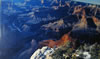 |
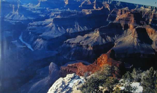
The Grand Canyon |
From the pines and firs of the eight thousand feet high Kaibab Plateau to the shadowy depths of its river gorge, some six thousand feet below the Grand Canyon represents the entire region in microcosm. As the river cut through layer after layer of gradually-rising rock, it with other forces of erosion, widened the chasm. This geologic wonder has become an open book on the natural history of the area.
 |
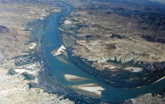
The Low Desert |
The driest and warmest of the rivers five faces, the Low Desert flanks the Colorado from Lake Mead to it's mouth on the mudflats of the Gulf of California. The river, more placid in these lower elevations, has fewer tributaries, but provides a welcome contrast to the arid mountains and shimmering valleys of the Mojave and Sonoran Deserts
===============================================
 |
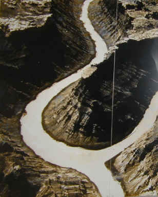
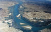
The Confluence of the Green and Colorado Rivers |
The Colorado River from it's headwaters to the confluence with the Green River was called the Grand River, when John Wesley Powell made his fact finding expedition from Green River, Wyoming to the end of Grand Canyon. The name of the Grand River, from the confluence with the Green River to it's headwaters in Colorado, was changed to Colorado River in the 1923, by legislation.
|